Star Atlas in Galactic Perspective and Comments on Star Atlas in Galactic Perspective.
Installed 25 Sept 2001 - Latest Update 16 Jul 2019.
New or changed text is in bold.
Use your browser vertical and horizontal scrolling functions to
move around the map
The galactic coordinates now in use are not the same as those used in the 1972 atlas. In each of the polar plots, below, lines for LII = 0o and LII = 270o are shown.
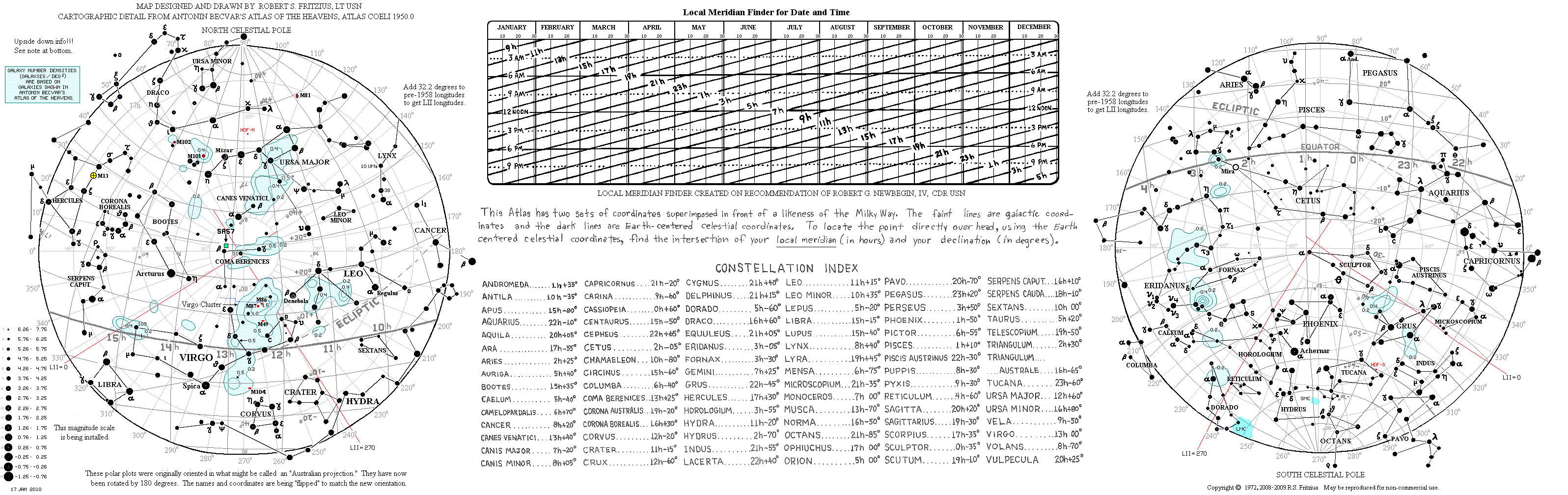
To see a track for Halley's Comet in it's 12 BC apparition (overlaid on this polar plot) goto: halley12.htm.
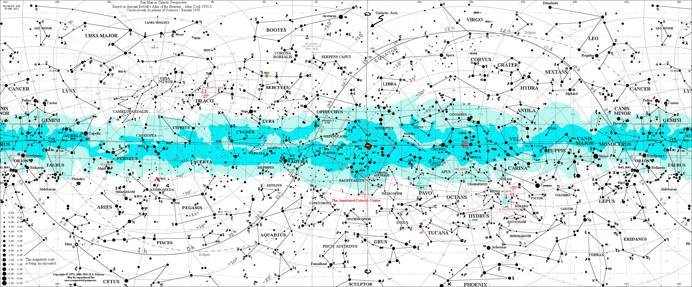
The Star Map above is a colorized version of a pen and ink
1972 Star Atlas by R.S. Fritzius
The two-color Milky Way representation and other cartographic details are
based on Antonín Becvár's Atlas of the Heavens - Atlas Coeli 1950.0
Czechoslovak Academy of Sciences - 1958.
The outlines of the Milky Way are according to:
A. Pannekoek, Die nördliche Milchstrasse (Leiden, 1920);
A. Pannekoek, Die südliche Milchstrasse (Lembang, 1929).
The 1972 star atlas has an uncertain amount of eyeball subjectivity
as to star magnitudes and positions. The same can be said
with regard to the positions of portions of the equatorial grid
itself. Some of these magnitude and position errors are being
reduced on this map. Also, I estimate that only about 60 percent of
the stars brighter than mag 3.5 actually made it onto the
original star atlas. The missing stars are gradually being installed.
A "post 1958" galactic-coordinates grid is gradually being added to the map.
It's lines will not completely straight because of the
equatorial lines position errors mentioned above. The black galactic
equator corresponds to Newcomb's pole.
The post-1958 galactic equator (shown in black) is tilted about 1.5 degrees
with respect to the pre-1958 galactic
equator (shown in blue). They coincide at 0 and 180 degrees galactic
longitude.
Galaxy Number Density contours are being installed in the polar maps. The
units for these densities are in galaxies per square
degree. The patterns are based on the galaxies plotted in Becvár's Atlas of the
Heavens. The density contours shown are not
locked in stone. By sliding the analysis grid(*) around, different
(but related) families of curves would be generated. Contour
lines are eyeball generated.
(*) Each bin in the grid is 3.16 degrees by 3.16 degrees square.
Barnard's Star, in Ophiuchus, R.A. 17h 55m DEC +04 33
Gamma-Ray Burst 990510, in Chamaelon, R.A. 13h 33m DEC -80d 14.5m
Lunar South Celestal Pole (just North of the Large Magellanic Cloud).
Supernova 1987a(*), in Large Magellanic Cloud, R.A. 05h 36m DEC -69d 18m
Supernova 2006gy, in Perseus, R.A. 03h 14m DEC +41d 13m
The constellation Hydra, which extends some 90 degrees across
the heavens (Galactic longitude 330 to 220,
and 35 degrees north of the galactic equator) seems to be laid out
(on purpose) parallel to the Milky Way.
Other constellations which follow
suit would include Centaurus, Orion, and Canis Major.
Cygnus and Aquila are
flying in the same direction parallel to the galactic plane.