As concerns the galactic equator there is no reason to think that the solar system is privileged to be located in the north/south center of the galactic disk.
1979 Gamma-ray Burst distribution data makes it look like the solar system is riding high (galactic northward) with respect to the apparent galactic equator (thick green horizontal line, below). The GRB density contours on the map show this effect. (Contours are subjective.)
The North/South angular anisotropy of gamma-ray bursts, as of 1979, are addressed by Mazets and Golenetskii(1). One main purpose of this webpage is to provide a more user-friendly galactic projection (set of projections) of the action. (The polar plots at the bottom are centered on the galactic poles, North: lower-left, South: lower-right. Plot latitudes are from +/-30 degrees to the respective poles.)
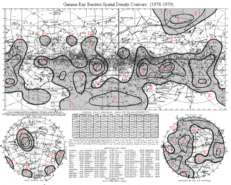
Gamma-Ray Bursters Density contours, 1979 GRB data
To see a larger version of this atlas (without the GRB information) go to sm-old.htm
References
Antonin Becvar, Atlas of the Heavens - Atlas Coeli, 1950.0
Robert Fritzius, Star Map in Galactic Perspective
Checking which Gamma-Ray Burst source was used to make the contours.