10. And as he transmitted to eternity his family and friends, so did he not neglect a memorial for himself, but built a fortress upon a mountain towards Arabia, and named it from himself, Herodium; and he called that hill that was of the shape of a woman's breast, and was sixty furlongs distant from Jerusalem, by the same name. . . . |
Thackeray's translation(3) of the passage reads: [Emphasis added]
|
(10) But while he thus perpetuated the memory of his family and his friends, he did
not neglect to leave memorials of himself. Thus he built a fortress in the hills on
the Arabian frontier and called it after himself Herodium. An artificial hilla,
sixty furlongs from Jerusalem, was given the same name, but more elaborate embellishments.
b [60 furlongs = 7.5 miles.]
a Literally " in the form of a breast."
|
Here is an excerpt from Vardaman's research on what he called the Herodium Beyond Jordan
and alternately, Herodium Facing Arabia. [Ref. (1), Page 1]
|
Almost all of the Herodian fortress palaces which are mentioned in
the New Testament and Josephus have now been identified satisfactorily. One of
those Herodian fortresses whose location still remains unknown is Herodium beyond
Jordan. This place is mentioned only by Josephus (War I. 21.10 [419]) in the
whole of the ancient literature now available. The following article is presented
because the writer feels that this lost fortress has been satisfactorily identified
in recent days. In relocating this spot, Perea's southern boundary in Herodian times
has been clarified, as well.
Various scholars have attempted to identify Herodium beyond Jordan, or to solve the problem in other ways. Charles Clermont-Ganneau believed that Herodium beyond Jordan was simply another name which Josephus used for Machaerus; he suggested that these two places were one and the same.1 Alexis Mallon, on the other hand, thought that El Hubeisa, in the area of the ancient "fields of Moab" in the Jordan Valley, was the true site of Herodium beyond Jordan. A. Segal boldy ventured the opinion that there was no "Herodium beyond Jordan," and that one should understand by this reference that Josephus means the same place as Herodium near Bethlehem.3 Other brief notices on Herodium beyond Jordan have appeared in recent years, but mostly older views have been restated and little or no real advance in locating the lost fortress of Herodium beyond Jordan has been made.4 Any new light concerning the location of Herodium beyond Jordan is welcome, therefore. ______________________ 1 See his Recueil d'Archéologie Orinetale. (Paris: E. Leroux, 1885-.) See: Vol. II (Juin 1897, Livraison 13), p. 200, note 2. Cf. A. Schlatter. Z.D.P.V, XIX, p. 228, Cf. A. Kammerer, Pétra et la Nabatène (Paris: P. Geuthner, 1929), Texte, p.246, n.1 and Carte I. 2 See his article in Biblica (1933), "Deux fortresses au pied des monts de Moab," pp. 401-407. Cf. F.-M. Abel, Histoire de la Palestine. Paris: Gabalda, 1952, I, p.371, note 5. 3 See I.E.J. 23 (1973), pp. 27-29; esp. p. 29, note 16; Cf. the author's response to Segal in I.E.J. 25, pp. 45-46, esp. 46. 4 For other material on this problem, see American Journal of Archaeology 35 (1934), p. 289; T.O. Hall, "Herodium in Perea," Interpreter's Dict.of Bible, Suppl. Vol., pp. 409-410; R.W. Funk, "Herodium," Interpreter's Dict. of Bible, Vol. 2, pp. 595-596, esp. p. 595. Does Funk Confuse "Idumea" with "Arabia" at that time? |
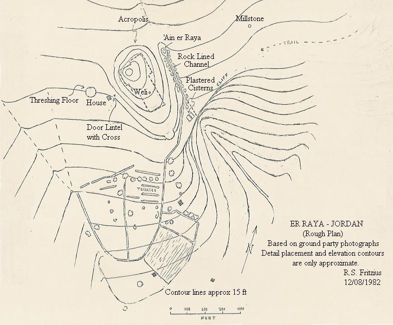
The following material deals with Dr. Vardaman's 22 July 1981 visit to the mound at er Raya, Jordan. The mound is his candidate site for Herodium Beyond (the) Jordan (River). [Ref. (1)]
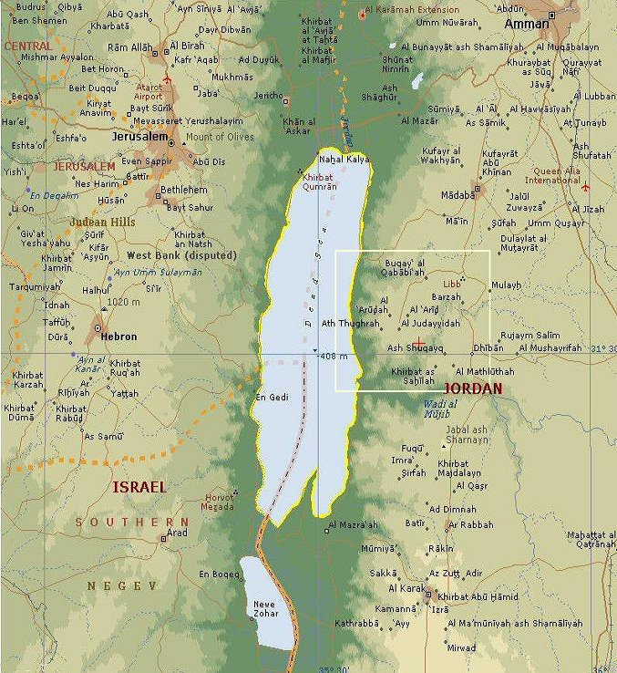
Dead Sea Region Showing er Raya Locale (The red cross inside the white frame represents the approximate location of er Raya.)
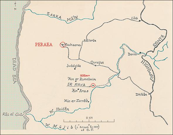
Vardaman's map showing the approach path to er Raya (dotted line) [Er Raya is five miles (8 km) Southeast of Machaerus.] According to historical sources, the Fortress of Machaerus was part of the defense system of the Jewish province of Perea near it's boundary with Nabatea. Dr. Vardaman conducted archaeological excavations at Machaerus in 1968.
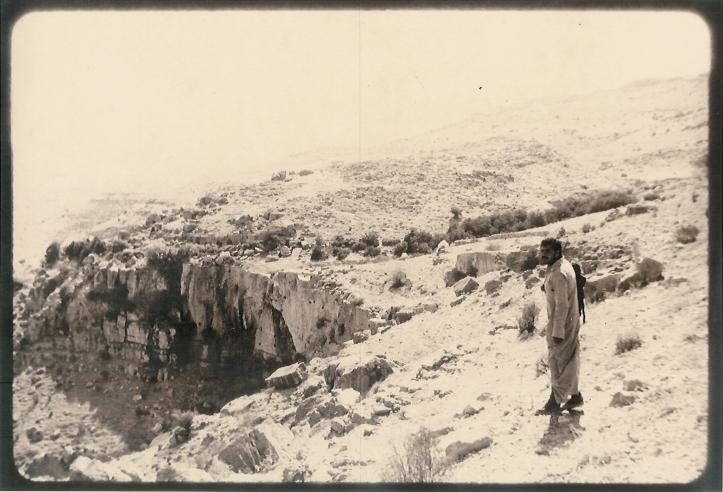
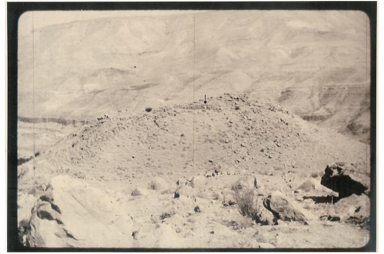
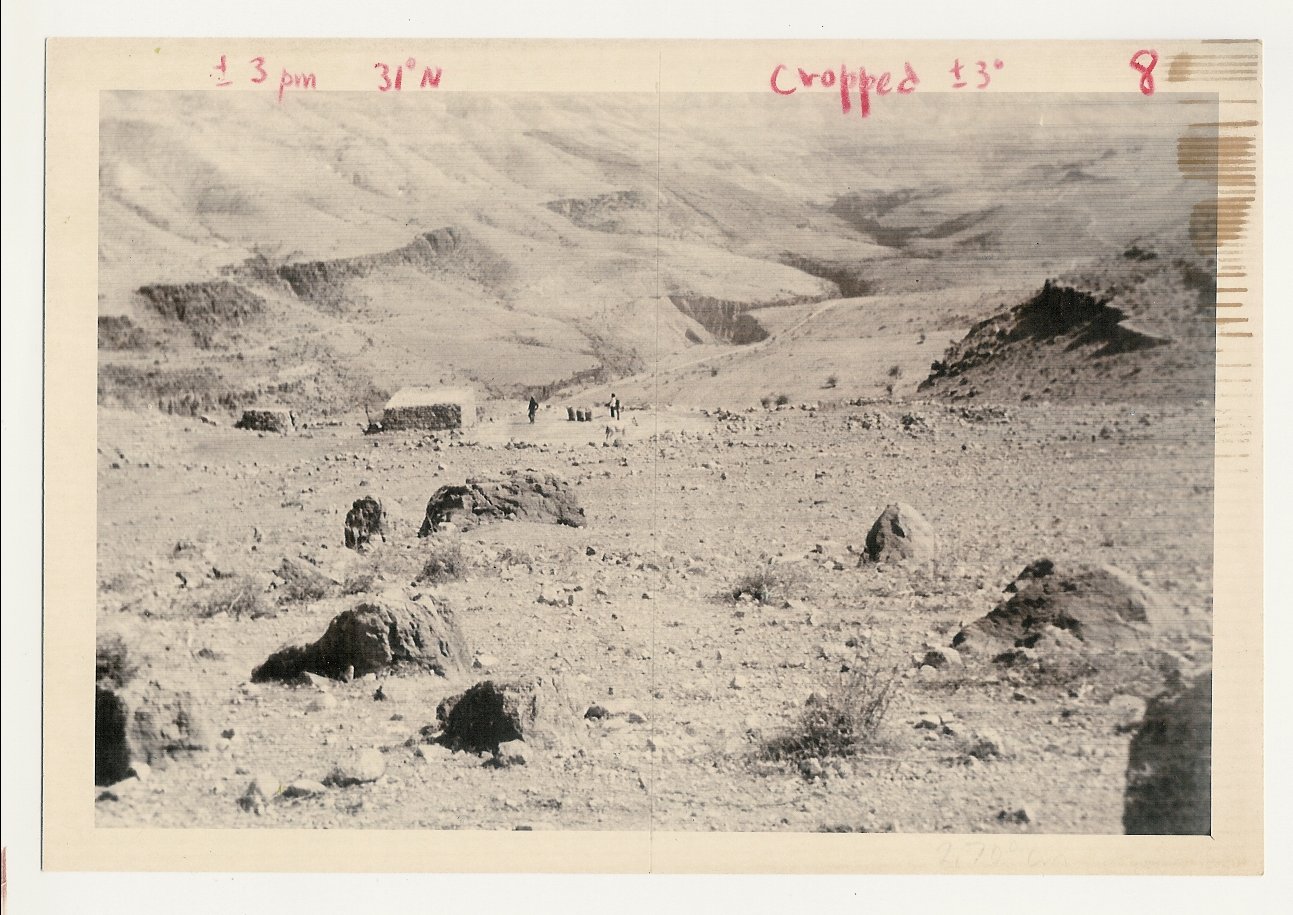
Approaching the mound at er Raya from the East - Photo by Jack Elliott. Jr.
|
"The view looks south and was taken from a spot north of the site. In the background one sees the Arabian hills which were watched over by Herodium beyond Jordan. One gets a good perspective of how large the mound was by comparing its size with the author who stands here on the northern part of the hill of er Raya." [Dr. Vardaman was about 6 feet tall.]
|
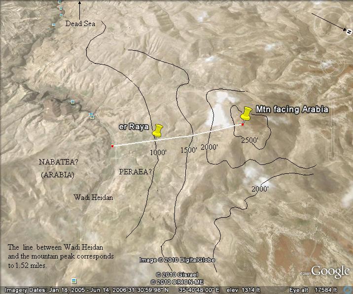
Wadi Heidan, which Vardaman thought may have been the border between Jewish Perea and
Arabian Nabataea in the first century BC, is in the valley beyond the mound.
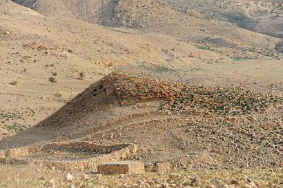
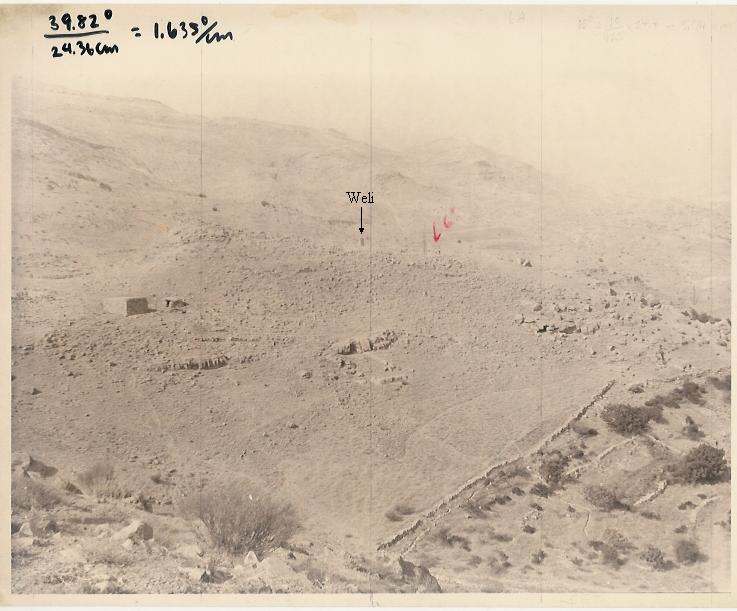
Mound at er Raya as viewed from the Southwest - Photo by Jack Elliott, Jr. "Weli" = burial marker (about same height as 6' figures, noted by red arrow)
* * *
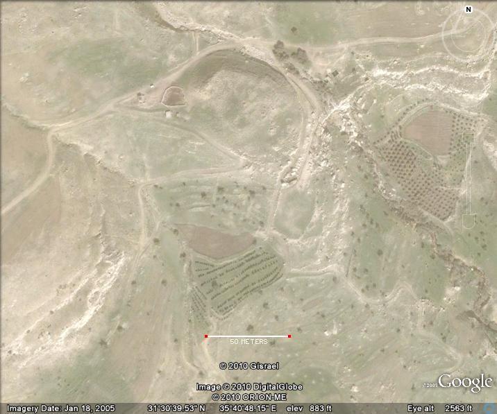
Two Google Earth images of the area are given here to provide a current picture of the mound area and the geography of the larger setting. (Note that Geographical North is not at the top of the second image.)
Vardaman's conclusion about the er Raya region was:
|
"... our research at er Raya certainly established that Herod's southern boundary of Peraea stretched as far as the Heidan. The Jewish coins found here are distributed in time from the early first century B.C., to the last half of the first century A.D., and argue forceably that during all of this period er Raya is to be thought of as located within the classical boundaries of Jewish Peraea, and not just within it during the Herodian period." [Ref. (1), Page 13c] |
(1) "The Lost Fortress of Herodium Beyond Jordan Rediscovered,"
Copyright 1981, E.J. Vardaman.
|
Contact: R.S. Fritzius at:
fritzius@bellsouth.net
Top