Space Photo of Canneto di Caronia
This page is an appendix to Part 2 of The Fires of Canneto di Caronia.
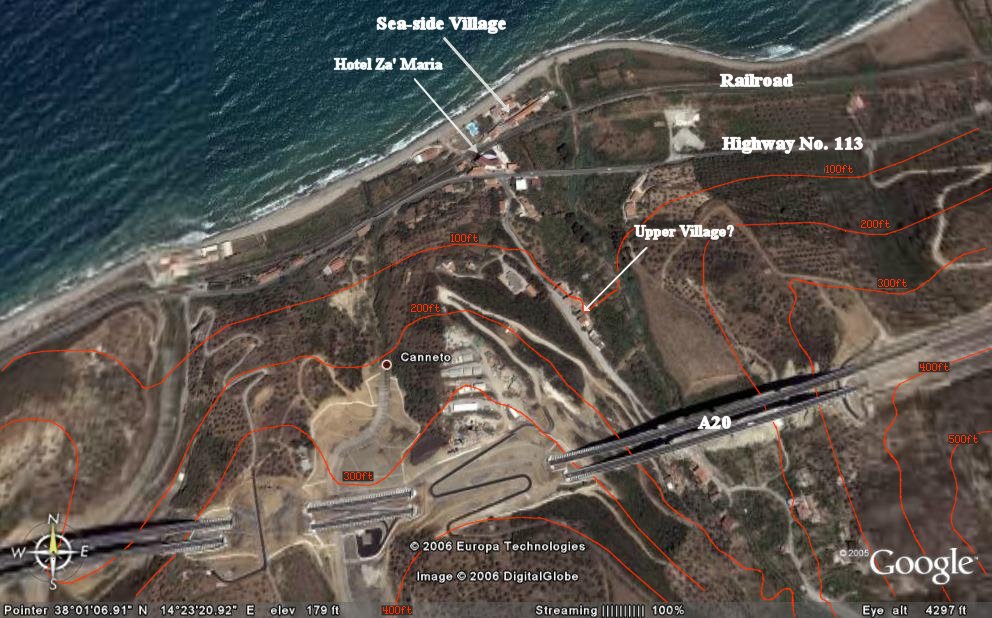
Image courtesy of Google Earth
[Installed 27 Jul 2006. Latest Update 27 Aug 2006.]
Elevation contour lines are based on Google Earth data. The accuracy of
any given point along the contours
is estimated to be plus/minus 200 feet in latitude and
longitude and plus/minus 50 feet in elevation.
Robert Fritzius:
fritzius@bellsouth.net
Top